
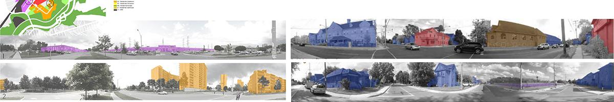
Create a visual panoramic image of zoning uses
Activity Type :
Comprendre
Participant Audience :
Residents
Field :
Urban Planning
Description
Take a camera or a phone and stand in one spot in the neighbourhood. Start to take pictures of the surrounding built form, pivoting to take a panorama (360 degrees). Record the spot on a map and in which direction you pivoted. The photos will then be stitched together in photoshop, and the different zoning uses will be coloured in.
What makes this tool valuable?
Cities designate or “zone” each building for a specific type of use. The purpose of a land use panorama is to give a more experiential illustration of different zoning uses. Couple the resulting panoramas with a traditional land-use map to create a fuller picture. When you stand in a particular spot what land/building uses are you surrounded by?
Tips & tricks
- Choose a few different areas of the neighbourhood to complete this activity.
- Make sure someone on your team has access to Photoshop, and has the required skills to stitch together the panorama and colour the buildings.
- Some smartphones have a panorama feature, which may reduce the amount of photo stitching needed.